Chinese PLA releases satellite images showing US military buildup near Iran

Akbar Novruz
Read moreHigh-resolution satellite imagery released by China’s military and commercial tech firm MizarVision shows a growing US military presence near Iran, amid reports that Washington may strike Tehran as early as this weekend, AzerNEWS reports.
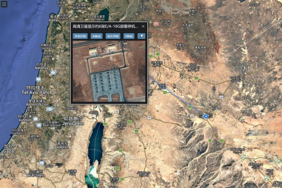
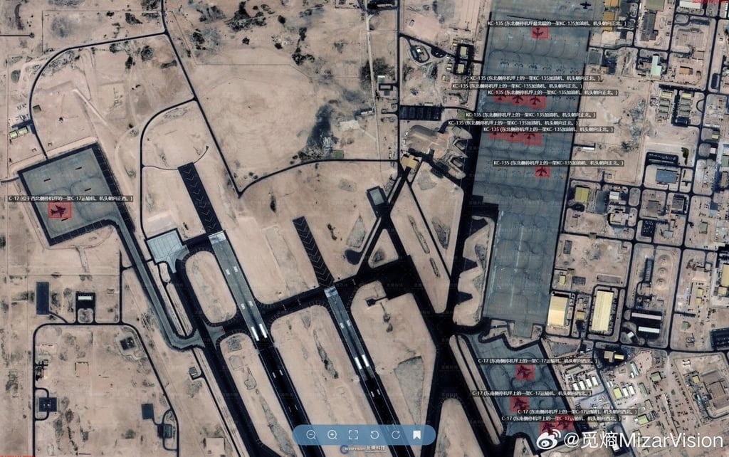
The images, shared on social media Thursday, show American deployments at bases in Qatar, Jordan, and Saudi Arabia. In Jordan, 18 F-35 Lightning II stealth fighters and six EA-18G Growler electronic warfare aircraft were visible on the tarmac at Muwaffaq Salti Air Base. Additional images show US C-130 and C-17 transport aircraft, KC-135 refueling tankers, and E-3C early warning aircraft at other regional bases, some in transit through Germany.
US media reports that President Donald Trump is considering a limited strike on Iran to pressure Tehran to abandon its nuclear programme, which Iran insists is peaceful. On Thursday, Trump warned during the Board of Peace meeting in Washington that “bad things” would happen if a deal was not reached and set a 10- to 15-day deadline for progress.
Tehran has responded with threats of retaliation and on Monday temporarily closed the Strait of Hormuz for live-fire military drills. Satellite imagery from MizarVision also shows Iranian deployments, including the drone carrier IRIS Shahid Bagheri and an escort warship near the coast.
Meanwhile, the People’s Liberation Army released a video titled “Siege of Iran: where will the US military launch its attack in the Middle East?” showing eight US bases under Chinese monitoring. The video highlighted Patriot air defense systems at Al Udeid, Al Dhafra, and Prince Sultan bases pointed toward Iran.
The release of such sensitive intelligence is unusual and underscores China’s growing space-based reconnaissance capabilities, which allow precise tracking of US military assets in regions far from East Asia. Chinese commercial satellites have previously been used to assess damage in conflict zones, including the Gaza Strip.
Here we are to serve you with news right now. It does not cost much, but worth your attention.
Choose to support open, independent, quality journalism and subscribe on a monthly basis.
By subscribing to our online newspaper, you can have full digital access to all news, analysis, and much more.
You can also follow AzerNEWS on Twitter @AzerNewsAz or Facebook @AzerNewsNewspaper
Thank you!