Azerbaijani cartographers prepare map of Zangezur Corridor
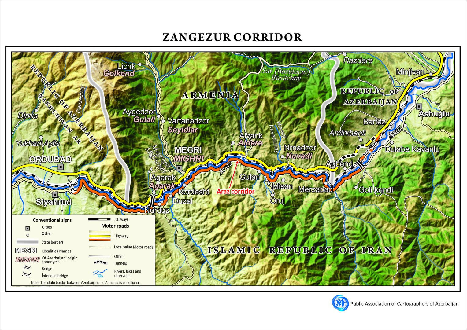
The Azerbaijani Cartographers Public Union has completed the preparation of a detailed map of the Zangezur Corridor, the strategic transport route linking mainland Azerbaijan with its Nakhchivan Autonomous Republic, Azernews reports.
According to the Union’s chairman, Mugabil Bayramov, the map was created using high-resolution satellite imagery as its base layer to ensure geographical precision and visual clarity.
Bayramov noted that the map illustrates the relevant sections of Azerbaijan, Armenia, and Iran, including residential settlements, highways, rivers, and mountain ranges along the corridor’s route. The Araz Corridor, another key regional transport connection, is also featured on the map.
The cartographic work has been produced in both Azerbaijani and English, highlighting its significance not only for national use but also for international research, academic, and policy reference.
Here we are to serve you with news right now. It does not cost much, but worth your attention.
Choose to support open, independent, quality journalism and subscribe on a monthly basis.
By subscribing to our online newspaper, you can have full digital access to all news, analysis, and much more.
You can also follow AzerNEWS on Twitter @AzerNewsAz or Facebook @AzerNewsNewspaper
Thank you!