Map of seismic risks in Azerbaijan to be developed soon
By Rashid Shirinov
The Republican Seismic Survey Center (RSSC) at the Azerbaijan National Academy of Sciences (ANAS) will soon sign a contract with the Geological Survey of Germany on implementation of the zoning project of Baku and Absheron Peninsula. The RSSC made the statement to Trend on August 5.
A preliminary agreement on the project was achieved at the recent meeting of the parties in Baku.
The contract for the project will be signed in mid-September of the current year between the RSSC and the Geological Survey of Germany. Details will be published by the end of the same month, the Republican Seismic Survey Center said. The project will be carried out during two years.
It will involve the creation of a map of seismic zoning of earthquake-risk zones in Baku and on the Absheron Peninsula. Zoning includes mapping of areas where seismic activity and impact on the infrastructure of water and gas supply will be measured on a point scale.
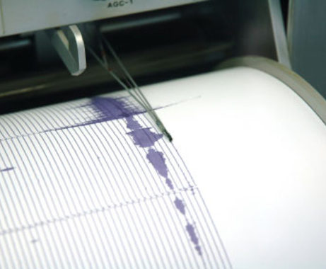
Meanwhile, the Republican Seismic Survey Center updated the software of seismic stations installed throughout the territory of Azerbaijan. The hardware and software platforms for seismic equipment were delivered by an American company Kinemetrics.
The system uses the latest version of the environmental monitoring, Antelope 5.6. Currently, the staff of RSSC passes through training on the use of new software.
The number of current seismic stations operating in Azerbaijan is 35, and they are all connected to the satellite system. The hardware platform consists of servers Aspenmac which are used in processing of data about earthquakes and their archiving.
The telemetry stations allow to conduct seismological observations and record earthquakes at close and far distance, to collect and process data about strong earthquakes on the territory of Azerbaijan and in neighboring regions. Based on this data, experts create mapping of epicenters, graphs and maps of seismic activity.
Overall, the seismogenic zones with potential to produce dangerous force cover the whole country as the Alpine-Himalayan seismic belt passes through Azerbaijan. Therefore, the country is considered to be a seismically active region – a lot of earthquakes occur across Azerbaijan every year, while majority of them are not felt.
Most seismically active zones in Azerbaijan are located in the Caspian Sea, cities of Shamakhi and Ismayilli, along the southeastern slopes of the Greater Caucasus, and in the Talysh Mountains. Since the beginning of the year, 4,849 tremors were recorded in Azerbaijan, and 57 of them were felt.
The map of potential seismogenic zones of Azerbaijan was prepared earlier to detect the risky zones of the country. The document reflects the seismic zones of the southeastern slope of the Greater Caucasus, Shamakhi-Ismayilli zone, Ganjabasar, northwestern zones including Sheki, Zagatala, Balaken, the northern zone of Guba, Siyazan, Devechi, Talysh zone, Nakhchivan Autonomous Republic, and Azerbaijani part of the Caspian Sea.
---
Rashid Shirinov is AzerNews’ staff journalist, follow him on Twitter: @RashidShirinov
Follow us on Twitter @AzerNewsAz
Here we are to serve you with news right now. It does not cost much, but worth your attention.
Choose to support open, independent, quality journalism and subscribe on a monthly basis.
By subscribing to our online newspaper, you can have full digital access to all news, analysis, and much more.
You can also follow AzerNEWS on Twitter @AzerNewsAz or Facebook @AzerNewsNewspaper
Thank you!