Azerbaijani villages under threat of overfloods
By Fatma Babayeva
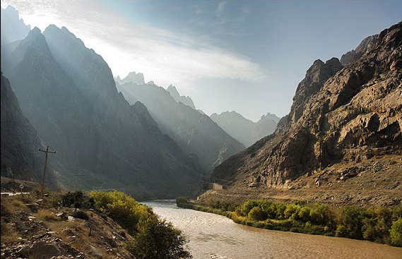
Seasonal increase in the water levels of rivers may pose serious danger for the nearby villages in Azerbaijan.
Experts revealed the names of areas under the threat of flooding by force of increasing water levels in the rivers flowing in the northern part of the country.
The deputy director of the Geography Institute under the National Academy of Sciences, Elbrus Alizadeh said there is a risk of overflood in the northern areas of Azerbaijan.
The northern rivers such as Kusarchay, Gudyalchay, Garachay and Velvelchay may pose a particular threat for the nearby settlements, Alizade believes.
So, most villages of Gusar, Guba and Khachmaz regions which are located in the foothills and lowlands are under flood threat, he added.
The scientist also explained the reasons of the overflood happened in Tangerud River in the Lerik region in the south of the country. The flood was expected after intense rains in the region. The soil is oversaturated with moisture and does not absorb rainwater, which flows into the river causing floods.
Alizadeh stressed that despite the necessary measures are taken to reduce the likelihood of floods, they are yet to be improved.
The valleys of the rivers which pass through the settlements and can cause flooding have to be cleaned from sullage. However, only valleys of few rivers have been cleaned from silt where there is a risk of mudflows. If the valleys of the rivers are cleaned in a timely manner, then the carrying capacity of the river bed will increase, he added. In order to protect from floods, the river banks need to be strengthened, and protective concrete barriers should be constructed.
He emphasized that realization of these measures will cost ten times less than the liquidation of the damage caused by floods.
The heavy rains in the Vizezemen and Shingedulan villages in Lerik region led to overfloods on April 16, in particular, bringing a bridge in the Tebrizli village out of use.
Furthermore, heavy rains caused landslides in some parts of the region.
Now water level comprises 120-150 percent of ten-day norm in the rivers of Guba-Khachmaz region located in the Major Caucasus, 80-105 percent in the rivers of the Minor Caucasus and 20-80 percent in the rivers of the Lankaran-Astara region, reports the Ministry of Ecology and Natural Resources in Azerbaijan.
Three-centimeter increase of the water level was recorded in the Kura River in Giragkasman on April 18.
Some 22-centimeter increase of the water level was observed in Ganig River in Ayrichai. At the moment, water consumption comprises 159 cube meter/second, namely 95 percent. However, this figure stood at 132 cubic meters per second which was equal to 79 percent of ten-day norm in 2015.
---
Fatma Babayeva is AzerNews’ staff journalist, follow her on Twitter: @Fatma_Babayeva
Follow us on Twitter @AzerNewsAz
Here we are to serve you with news right now. It does not cost much, but worth your attention.
Choose to support open, independent, quality journalism and subscribe on a monthly basis.
By subscribing to our online newspaper, you can have full digital access to all news, analysis, and much more.
You can also follow AzerNEWS on Twitter @AzerNewsAz or Facebook @AzerNewsNewspaper
Thank you!